It’s been a while since I wrote something for this series about the lines that society, government, and industry have drawn around us. In previous editions I have focused on area codes and phone exchanges, municipal boundaries as they relate to retail development, and the lines that bisect one Pittsburgh area neighborhood.
As I was in the process of writing this, KDKA-TV reported on the controversy surrounding a teenage water vendor at an intersection that constitutes the boundary between Edgewood and Wilkinsburg – two of the four communities that claim a portion of Regent Square.
The issue was resolved by the young entrepreneur crossing the intersection into Wilkinsburg, where the local government seemed much more understanding and appreciative of his efforts than the reticent officials in Edgewood.
Such is the nature of imaginary lines, and the power structures behind them…
This time I will explore the lines drawn by the United States Post Office Department, later reorganized as the U.S. Postal Service (USPS), for the routing and delivery of mail. These lines have been fashioned across history by the settlement of our nation – wherever the people went, there was a need to establish delivery routes and post offices around those population centers.
YOU Get a Post Office, and YOU Get a Post Office…
In the Sewickley area, we are able to see how postal services first evolved thanks to a very informative article in the February 2018 issue of the Pennsylvania Postal Historian, the quarterly bulletin of the Pennsylvania Postal History Society.
Beginning on Page 17, author Daniel Telep details the founding, movement, and consolidation of numerous post offices across the Quaker Valley communities, dating back to the first post office in the Sewickley area –
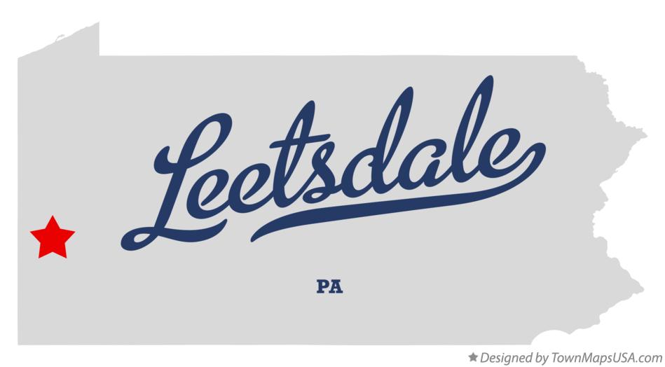
Opening on January 9, 1824, the Sewickley Bottom post office…operated out of the home of David Shields who was its only postmaster…That office was discontinued on September 1, 1857 but moved and reopened as Leetsdale on February 4, 1867…That office closed on October 18, 1872, but again moved and reopened on July 30, 1873. Today it operates as zip code 15056, Leetsdale.

The David Shields House, “Newington”, located at Beaver Road and Shields Lane, Edgeworth – National Archives
The David Shields House in “Sewickley Bottom” – now Edgeworth – is also known as “Newington”. It is one of the crowning examples of historic architecture in the Sewickley Valley, and is listed on the National Register of Historic Places.
Mr. Telep also tells us that the first Sewickley post office opened on Beaver Street in 1851 as “Sewickleyville”. The name change to Sewickley came in 1871. The grand, impressive Sewickley Post Office on Broad Street opened in 1912, and served in that role until 1981. Today the building houses Sweetwater Center for the Arts and the Sewickley Valley Historical Society.
Many other small post offices served the Quaker Valley area. According to Mr. Telep –
Glenfield, Pa. had a post office…which opened on January 28, 1876 and operated continuously until its discontinuance on November 30, 1969 when the new Interstate 79 road project bought up and eliminated most of the town. The Dixmont post office opened further down the Ohio River on June 30, 1861 in the hospital at the Dixmont Insane Asylum complex…and didn’t close until January 31, 1954. Both the Glenfield and Dixmont offices were absorbed into the Sewickley post office.
On July 26, 1889 the Shields post office opened one mile away from the Leetsdale office, operating until August 31, 1938, when it too was absorbed into the Sewickley office.
The Edgeworth Station post office opened on January 15, 1899 and closed on November 20, 1904…The last post office absorbed into the Sewickley office is Haysville, Pa., January 20, 1890 to December 31, 1949. Just west of Leetsdale the post office of Fair Oaks, Pa., January 14, 1898, to January 31, 1955, was absorbed into Leetsdale, zip code 15056.
The last sentence above raised additional questions about the Fair Oaks neighborhood of Leet Township and Bell Acres Borough. This neighborhood has a mailing address of Ambridge, 15003. If the Fair Oaks post office was absorbed by Leetsdale, why was the neighborhood it served assigned to the Ambridge postal zone?
I was able to contact Mr. Telep in an attempt to clarify this. He referred me to the book Pennsylvania Postal History, by John L. Kay and Chester M. Smith, Jr. (Quarterman Publications, Inc., 1976). According to this volume, the Fair Oaks post office actually reopened on February 3, 1955, and closed for good on August 31 of the same year. An additional notation indicates “Fair Oaks 15003” on the following day, September 1. This would appear to indicate that mail service was thereafter provided through the Ambridge post office.
Mr. Telep speculated on possible political reasons for the short-term reopening of the Fair Oaks location. However, additional evidence suggests operational challenges may have played into this. According to Sewickley Herald reporting in the mid to late 1950’s, the Post Office Department was actively seeking proposals for the relocation of the Leetsdale post office, possibly owing to an anticipated jump in volume with the 1954 development of the Buncher Industrial District, now known as Buncher Commerce Park.
This need was likely addressed with the opening of Quaker Village Shopping Center in August 1963. The post office relocated from Ferry Street to the shopping center in 1965 or 1966.
Increased workload, and the lack of immediate capacity to respond to it, may have been key factors in the decision to assign Fair Oaks to the Ambridge postal zone.

The former Leetsdale Post Office, 23 Ferry Street. The post office is currently located in the Quaker Village Shopping Center. In this photo the building is occupied by Sewickley Stained Glass. It now houses Sewickley Antiques. – John Peel
With regard to all of these post offices consolidating, Mr. Telep wrote –
One can only speculate that these…offices within the 3 mile radius from present day Sewickley were opened because of their local identities, social ties, neighborhood rivalries and local political influence. Convenience and prestige dictated the openings of the offices, but governmental budgeting pressures and population shifts resulted in their closings.
While the realities of economics and demographics appeared to prevail in the consolidation of these facilities, many of the above-mentioned factors continue to play a role in the operations of numerous local governments and associated agencies across our region.
Rural Past to Suburban Present
For those situated in rural areas, the development of Rural Free Delivery across the turn of the 20th Century provided a reliable, well administered system to get mail to and from remote and agricultural areas. According to United States Postal Service historical data, Sewickley established RFD service in 1903 – the same year it got a weekly newspaper.
As America’s population and businesses grew, and development began creeping into what was farmland or subdivided from large estates, the USPS devised the ZIP Code system to optimize the routing and delivery of mail.
As the blog of a Washington, DC design firm was helpful in pointing out, ZIP codes are designed with the mail carrier in mind.
When Postal Inspector Robert Moon first proposed zip codes in 1944, he was not thinking about how they would look on a map. He was hoping they would add some efficiency to an increasingly overwhelmed mail delivery system. So rather than laying out areas “as the crow flies,” the USPS had to lay out areas “as the mail carrier hoofs it.” That’s how you get portions of zip code areas meandering off in strange directions, stopping and starting again, and winding around themselves. It was built for people following already-established roads and navigating communities.

ZIP Code boundaries for northwest Allegheny County lined and labeled in blue. Municipal boundaries are light green, with municipalities labeled in black. Click image to enlarge. – Allegheny County GIS / John Linko
As the above map illustrates, these postal zones were created in relationship to the largest population center proximal to that particular area when the boundaries were drawn. Small, unincorporated villages such as Wexford, Gibsonia, and Allison Park hosted the post office for what were largely rural, undeveloped agricultural surroundings.
With the advent of Enhanced 9-1-1 service, beginning in the 1970s actual street addresses began to replace the “R.D.” number and box system, and many locales that were changing radically in the face of sprawl became edified for future generations.
By virtue of their presence on every piece of mail delivered to the sprawling subdivisions and commercial centers that today cover much of that former farmland, these little villages maintain their tangible presence in the minds of the inhabitants, even if they are in many cases an anachronism – and sometimes an annoyance.
I say this because in the conduct of my work, postal zones may create confusion that can become an impediment to quickly identifying the location of an emergency.
For example, when a resident insists they live in “Gibsonia”, it actually means they live in any one of five different municipalities – Pine, Richland, West Deer, and Hampton Townships, and the Town of McCandless. Four different school districts cover this area as well.
As with “Wexford”, “Allison Park”, “Warrendale”, and numerous others, there is NO City of “Gibsonia”. In an emergency, what matters is the municipality where you are located.

Close-up of the Sewickley postal zone, which covers all Quaker Valley communities except Leetsdale and the Fair Oaks neighborhood of Leet Township and Bell Acres Borough. It also covers the majority of Franklin Park Borough and a good chunk of Ohio Township. Click image to enlarge. – Allegheny County GIS / John Linko
Similar confusion can result from the extension of a postal address into areas well outside an established community’s municipal boundaries. The attractiveness of certain postal addresses from a marketing standpoint often results in the stretching of what is reasonable.
For example, the developers of subdivisions, apartment complexes, and senior living communities have often invoked the word “Sewickley” as part of the description or name of a development project, when the actual location shares very little with Sewickley proper outside of the ZIP code. Many of these locations are in Franklin Park Borough or Ohio Township, and are actually more convenient to other communities such as “Wexford” (parts of McCandless, Pine Township, Franklin Park, and Marshall Township) for groceries or other services.

Aerial view of the intersection of Wexford Bayne Road (State Route 910) and Nicholson Road in Franklin Park Borough, with associated businesses and the I-79 Wexford interchange. Though considered by many as part of the Wexford community, the postal zone / mailing address for this area is Sewickley, 15143.
This has had an increasing level of importance this year, with the pandemic creating additional demand for delivery services from all manner of businesses. ZIP codes provide business owners with an easy-to-implement set of delivery area boundaries.
Tell that, however, to those who are shut out of some delivery services due to their placement on the “wrong” side of a postal boundary. A recent post on the social media site Nextdoor.com lamented the writer’s location on the Fair Oaks side of Leet Township, which prevented deliveries from the Whole Foods Market in “Wexford” that friends on the Quaker Heights side of the township were able to receive. Seems that the store’s delivery area includes Sewickley 15143, but not Ambridge 15003.
The Media Helps…and Hinders
Media outlets seem to have different ideas on how to utilize postal and actual locations when reporting the news. The staff of Trib Total Media, especially their Westmoreland County bureau and the Valley News-Dispatch, appear to be meticulous in identifying locations, i.e. “the Natrona section of Harrison Township“.
I found some disparate style in a recent visit to the website of the Pittsburgh Business Times. The contrast is illustrated by two stories – “Rock ‘n’ Joe opens new location in Gibsonia” and “Judge upholds denial of UPMC’s permit to build Jefferson Hills hospital“.
In the first example, the new business is in Pine Township, but the reporter chose to use its arcane Gibsonia postal address to identify the new location.
In the second example, the reporter specifically refers to the proposed UPMC South location as being in Jefferson Hills Borough, when the postal zone for the address is Clairton, 15025.
I reached out via e-mail to the Business Times with questions about the use of locations in their reporting. While I did not receive a response, I’m hopeful that any perceived socioeconomic bias about the use of certain postal zones would not impact the way they choose to report location information.
All bets are off when it comes to advertising, however. The little jingle that sticks in the head of any Pittsburgher of certain years would not sound as nice if it said that Century 3 Chevrolet was in West Mifflin, where it is actually located.
Proactive Government Shapes Their Own Identity
It appears that the haphazard growth of many areas contributes to the edification of postal zones bearing the names of ancient communities that have little relevance to the present day. However, this is not always the case.
Just across the Butler County line lies Cranberry Township, historically identified by post offices in the hamlets of Ogle and Hendersonville, and by its economic “center”, Crider’s Corners.
It’s then somewhat surprising to see ZIP code 16066 named after the township, and the postal zone boundary quite nearly matching that of the township.

The Cranberry Township postal zone, which closely follows the municipal boundary with the exception of the Thorn Hill Industrial Park. – here.com
While officials at both Cranberry Township and the Cranberry Historical Society did not respond to email requests for comment, it would appear that the change happened after 1983, when the Seven Fields townhouse development seceded from Cranberry to form Seven Fields Borough. Seven Fields is in the Mars (16046) postal zone.
There are other local examples of this type of progress. Growing up, I remember going through the villages of Wireton and Glenwillard along Route 51. Those familiar will recognize these towns as part of Crescent Township. The former Glenwillard post office has been re-named “Crescent”.
After an e-mail inquiry, an unnamed township official replied with the following –
This happened over 20 years ago. Can’t really give you a lot of information. We had 5 different zip codes back then all for Glenwillard. The Commissioners decided to merge them all together into what is Crescent, PA 15046.
So it appears to be possible for local governments and municipal planners to appeal to the Postal Service to adjust boundaries and rename postal zones (within reason) to reflect modern changes to the communities that the postal zone serves. This also helps to explain why the Coraopolis (15108) postal zone has a listed alternate name of Moon Township.
Can the USPS re-orient the jigsaw-like configurations of Sewickley and other postal zones to reflect the proliferation of growth in what were once rural areas? As the zones were designed to better facilitate delivery and not necessarily municipal identity, what are the possibilities?
The Least of Their Problems…
Considering recent news coverage concerning the Trump administration’s ideas toward “improving” the USPS, it’s possible that among those improvements could be a mail routing system that can be scaled and/or modified to recognize shifts in population and utilization patterns.
It doesn’t appear that those things are a priority for now. Combined with a well-reported hue and cry among citizens and elected officials alike, as well as scrutiny from one of the few U.S. Inspectors General that Trump hasn’t attempted to marginalize and/or replace, the Postmaster General appeared to back off from service reductions that could threaten the integrity and reliability of the U.S. mail, especially as it concerns the November election.
Unfortunately, this doesn’t appear to be having the necessary impact on recent service reductions, which have had a practical impact on all manner of time-sensitive mail unrelated to the upcoming general election – from prescription drugs to live chicks.
Navigation Is Essential
As that election approaches, and the pandemic shows continued persistence in its ability to disrupt our society and economy, it is more imperative than perhaps at any time in our recent history that our citizenry become more cognizant of Situational Awareness, defined simply as “being aware of what is happening around you and understanding what that information means to you now and in the future.”
A big part of Situational Awareness is taking stock of the factors and variables that come into play not only when faced with circumstances out of the ordinary, but in our routine daily existence.
The influence of the lines drawn for the provision of services and/or the conduct of government, and our individual awareness of that influence, helps to shape how we conduct ourselves as citizens, consumers, and human beings.
The bottom line associated with this is painfully simple, yet complex in the wake of all of the lines we draw around ourselves, or have had drawn around us –
Know where you are – it may save your life.
Have a good rest of the summer.
Acknowledgments – Daniel Telep, Sewickley Herald Digital Archive, My Beloved Leetsdale Facebook Group







Pingback: Election Postscript – Readin’, ‘Ritin, Repudiation, Resolve, Renewal | John Linko